


In a significant shift from a prolonged cold spell, today witnessed a temperature spike, reaching highs near 60°F. The day commenced with unseasonably warm temperatures that climbed into the 40s before sunrise and peaked in the upper 50s to low 60s. However, this warmth is expected to be short-lived as an incoming arctic front will dramatically alter the weather conditions. As night approaches, the forecast indicates that temperatures will plummet, marking a return to frigid conditions throughout the region. This swift change in temperature serves as a reminder of the unpredictable nature of winter weather.
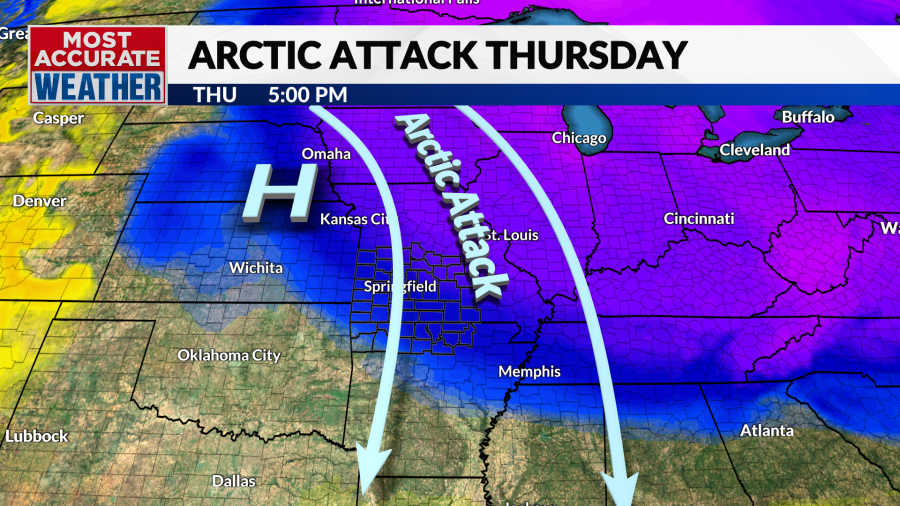
The arrival of the arctic front is anticipated near midnight, bringing with it gusty winds and a drastic drop in temperatures. By morning, residents can expect the mercury to fall to the upper teens and 20s, with wind chills that could make the air feel like it’s in the single digits. This abrupt transition will usher in a period of bitter cold, with afternoon temperatures across much of the Ozarks remaining below freezing. Such temperature swings highlight the need for residents to prepare for drastic changes in outdoor conditions.
As the week progresses, the frigid weather will linger into Friday morning, creating a sense of winter’s grip on the area. However, there’s a glimmer of hope as the weekend approaches, promising a warmth refreshment. Forecast models suggest that winds will shift from the north to the southwest, bringing milder air masses that should lead to rising temperatures. This forthcoming warm-up provides a welcome reprieve from the harsh cold experienced earlier in the week.
Sunday’s forecast indicates a rapid increase in cloud cover, which could hinder the anticipated warm-up. The possibility of rain is primarily expected to affect areas south of Interstate 44 during the afternoon hours. These developing weather patterns reveal the complexities of transitioning seasons, as rain can signify both a warmth spell and the remnants of winter’s influence persisting. The interplay between temperature increases and cloud cover will be important to monitor as it could impact outdoor plans for the weekend.
Looking ahead to Monday, conditions are expected to serve as a transitional phase in this notable weather pattern. This day may be characterized by varying temperatures along with the presence of clouds. As residents wind down the weekend, the anticipation of another shot of winter air looms just around the corner, set to arrive on Tuesday. The outlook suggests that winter is not ready to relinquish its hold, and individuals should remain vigilant about changing weather conditions.
In conclusion, this week exemplifies the volatility of winter weather, underscoring the quick simultaneous shifts between warmth and cold. While the present temperature spike welcomes an end to the cold snap, it is merely a brief interruption in what appears to be a continued struggle between seasonal temperatures. With the promise of weekend warmth quickly escalating to the potential for winter conditions next week, it is essential to stay updated on forecasts and prepare for the evolving weather landscape. The region’s residents are thus advised to download the KOLR 10 weather app to keep informed as conditions change.


